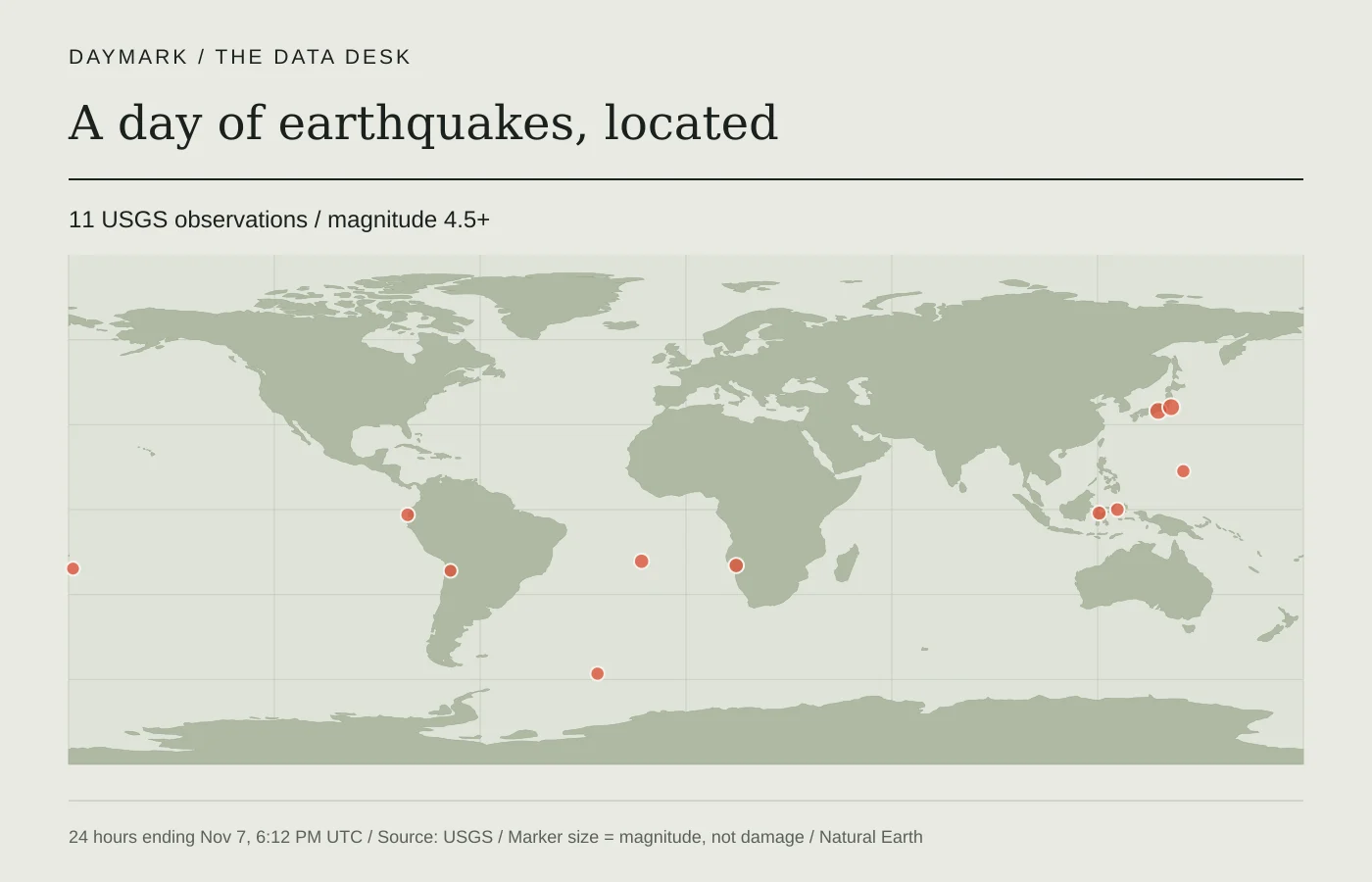
The events behind the story
11 observationsNov 6, 6:05 PM – Nov 7, 6:05 PM UTC. USGS events of magnitude 4.5 or higher. Magnitude describes the event, not local damage.
View the earthquake observations
| Location | Magnitude | Time | Depth |
|---|---|---|---|
| 45 km NNW of Salinas, Ecuador ↗reviewed | 4.7 | Nov 7, 5:17 PM | 10.0 km |
| 10 km NW of Hamakita, Japan ↗reviewed | 5.5 | Nov 7, 4:04 PM | 38.1 km |
| 77 km NNW of Khorixas, Namibia ↗reviewed | 4.9 | Nov 7, 3:22 PM | 8.0 km |
| Fiji region ↗reviewed | 4.5 | Nov 7, 3:05 PM | 571.9 km |
| southern Mid-Atlantic Ridge ↗reviewed | 4.9 | Nov 7, 11:35 AM | 10.0 km |
| 74 km NE of Hasaki, Japan ↗reviewed | 5.5 | Nov 7, 11:07 AM | 31.7 km |
| 57 km SW of Ollagüe, Chile ↗reviewed | 4.5 | Nov 7, 10:53 AM | 110.7 km |
| 156 km ESE of Modisi, Indonesia ↗reviewed | 4.7 | Nov 7, 9:47 AM | 38.5 km |
| South Sandwich Islands region ↗reviewed | 4.6 | Nov 7, 7:14 AM | 103.7 km |
| 11 km ENE of Yigo Village, Guam ↗reviewed | 4.6 | Nov 6, 10:37 PM | 113.4 km |
| 36 km WNW of Poso, Indonesia ↗reviewed | 4.8 | Nov 6, 7:07 PM | 10.0 km |
The U.S. Geological Survey's magnitude 4.5-and-above feed supplied 11 qualifying earthquakes in the rolling day from 2026-11-06 18:05 UTC to 2026-11-07 18:05 UTC. This is a snapshot of that source window, checked by Daymark and presented with the event records below. It excludes smaller events and entries classified by USGS as another type of seismic event. It should not be read as the total number of earthquakes that happened worldwide.
The most recent listed event was magnitude 4.7, described by USGS as “45 km NNW of Salinas, Ecuador,” at 2026-11-07 17:17 UTC. Its reported depth was 10.0 kilometres. The highest listed magnitude in the window was 5.5; one event with that magnitude was “10 km NW of Hamakita, Japan,” at 2026-11-07 16:04 UTC. These are source measurements and location descriptions, rather than observations by a Daymark reporter.
Magnitude describes the size of an earthquake at its source. It does not tell us how strongly every community shook or how much damage occurred. Local shaking depends on factors including distance, depth, and ground conditions. A magnitude in this table is therefore insufficient evidence for claims about injuries, damaged buildings, or disruption. The briefing makes no such claims from these measurements alone.
At the time of this source snapshot, 11 entries were marked reviewed and 0 were marked automatic. Those labels describe the USGS record's review status, not independent verification by Daymark. The location, magnitude, depth, and status can be revised as additional information becomes available. The source links identify the individual event records so readers can inspect subsequent revisions.
Read the table as separate fields. Event time is when the earthquake was recorded as occurring; source update time is when its record was revised. Coordinates locate the reported epicentre, while depth gives the source's estimate of its vertical location. A location such as a distance from a town is the source's geographic description and does not establish the effects in that town. All displayed times use UTC so cross-border comparisons share one clock.
The USGS source record can include a raw tsunami flag. It is not a confirmation that a tsunami occurred or a substitute for an official warning. Likewise, the sequence of events here is not a prediction of another earthquake. For current local instructions, use the responsible emergency authority and official warning services. This data briefing offers a traceable record and reading context; it does not provide emergency guidance or a damage assessment.
Go to the sources
- USGS: Magnitude 4.5+ earthquakes, past day
- USGS: Earthquake magnitude, energy release and shaking intensity
- USGS: GeoJSON feed documentation
- USGS: M 4.7 — 45 km NNW of Salinas, Ecuador
- USGS: M 5.5 — 10 km NW of Hamakita, Japan
- USGS: M 4.9 — 77 km NNW of Khorixas, Namibia
- USGS: M 4.5 — Fiji region
- USGS: M 4.9 — southern Mid-Atlantic Ridge
- USGS: M 5.5 — 74 km NE of Hasaki, Japan
- USGS: M 4.5 — 57 km SW of Ollagüe, Chile
- USGS: M 4.7 — 156 km ESE of Modisi, Indonesia
- USGS: M 4.6 — South Sandwich Islands region
- USGS: M 4.6 — 11 km ENE of Yigo Village, Guam
- USGS: M 4.8 — 36 km WNW of Poso, Indonesia
Our editorial standards explain how sources and automated briefings are handled.